291/2 Le Van Hien, Da Nang, Vietnam
hi@simplyvietnamtravel.com
+84 793 553 385
Mon – Sun 8.00 – 18.00
 travel
January 13, 2026
travel
January 13, 2026

The journey from Da Nang—the vibrant “capital” of Central Vietnam—to the thousand-year-old capital of Ha Noi is more than just a geographic transition; it is a voyage through the cultural and historical layers of the S-shaped land. For travelers, determining how far is Da Nang to Ha Noi is a vital preparatory step in establishing an optimal itinerary, whether for a swift business trip or a spontaneous, free-spirited adventure. To answer this question comprehensively, we must analyze the distance through multiple lenses: from the straight flight paths above the clouds to the winding coastal roads and the iron rails piercing through challenging terrains.
When searching for the keyword how far is Da Nang to Ha Noi, travelers often encounter varying figures depending on the mode of transport and the specific route. In reality, this distance is categorized into four main reference systems:

This is the shortest mathematical distance connecting the GPS coordinates of Da Nang International Airport (DAD) and Noi Bai International Airport (HAN). This distance is approximately 608 km. Commercial flights typically follow the most direct path possible to optimize fuel, resulting in an actual flight time ranging from 1 hour 15 minutes to 1 hour 30 minutes.
According to data from the Directorate for Roads of Vietnam, the distance from Da Nang to Ha Noi along National Highway 1A is about 763 km. This is the nation’s busiest artery, directly connecting Central coastal provinces such as Thua Thien Hue, Quang Tri, Quang Binh, Ha Tinh, Nghe An, Thanh Hoa, Ninh Binh, and Ha Nam before reaching the gates of the capital.
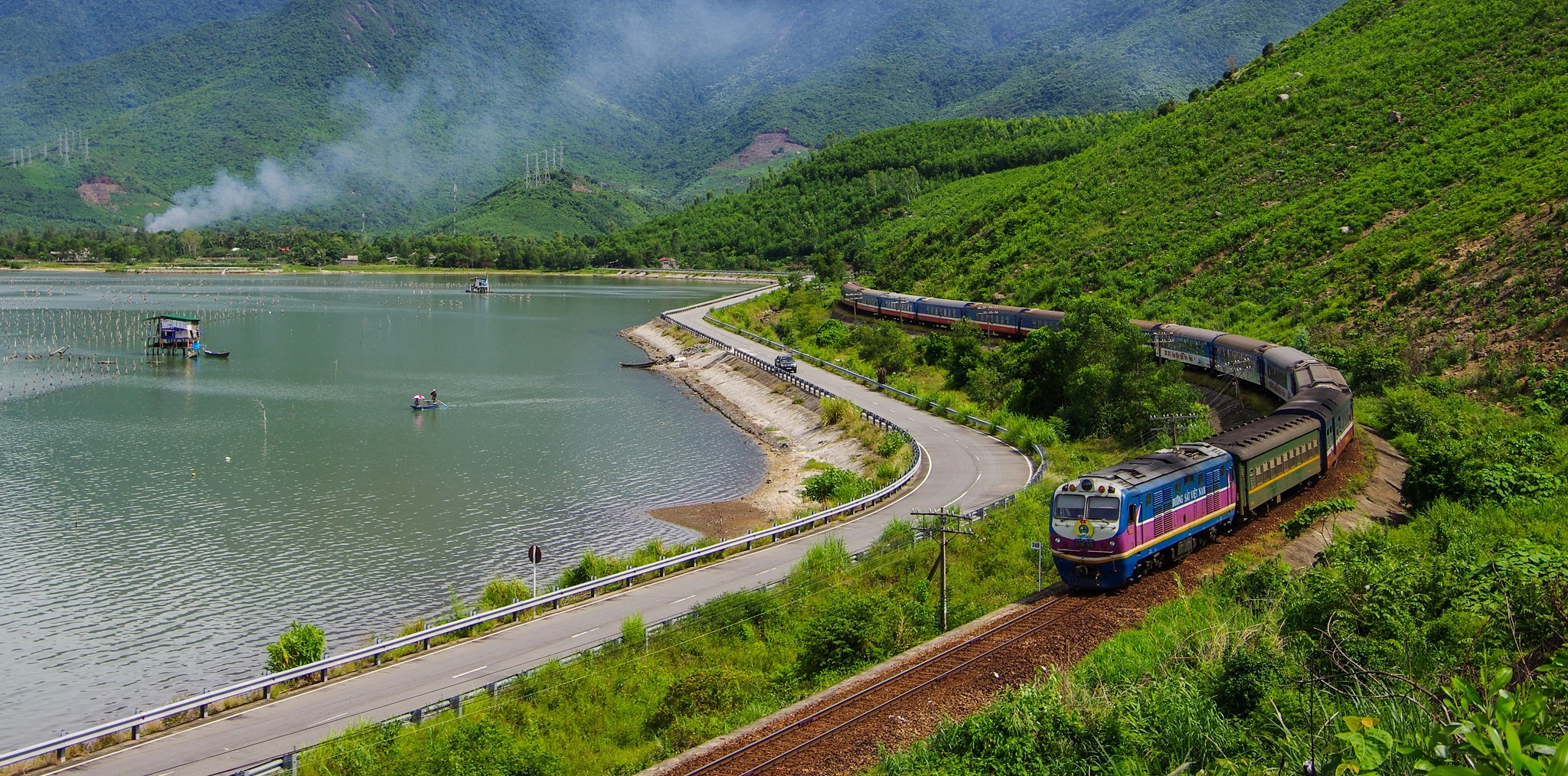
The North-South railway follows a more specialized route, curving through mountainous terrain and bypassing certain densely populated areas. The total length of the tracks from Da Nang Station to Ha Noi Station is approximately 791 km. While longer than the road route, it offers the most spectacular views, especially when passing through the Hai Van Pass and the Central lagoons.
For those who love exploring the pristine beauty of the Truong Son Mountains, this route is significantly longer, approximately 950 km – 1,000 km. However, it features fewer heavy trucks, fresher air, and some of the most majestic landscapes in the country.
The Da Nang – Ha Noi air corridor is one of the busiest in Southeast Asia.

In recent years, the Slow Travel trend has made trains more popular than ever.
If you choose to drive (car or motorbike), calculating how far is Da Nang to Ha Noi must be paired with strategic stopovers to ensure health and safety.
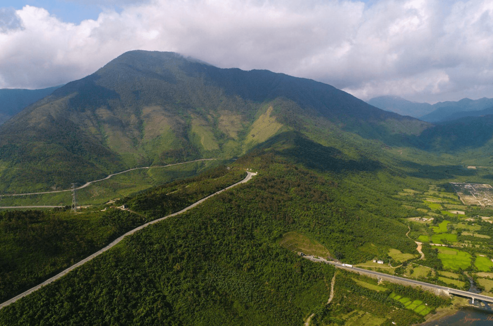
This is the heritage route. After leaving Da Nang, you will conquer the Hai Van Pass—the “most marvelous pass in the world.” Stop in Hue to savor royal cuisine before heading toward Dong Hoi, Quang Binh.

The road here is flat but requires speed caution when passing through residential areas in Ha Tinh and Vinh. This is the land of historical figures and pristine beaches like Thien Cam and Cua Lo.
This is the final sprint. After passing Thanh Hoa, you will access the North-South Expressway (Ninh Binh – Cau Gie segment), significantly shortening the travel time into inner Ha Noi.
To provide a realistic perspective, we have compiled an estimated cost comparison table (Updated for 2026):
| Mode of Transport | Estimated Cost (VND) | Travel Time | Suitable For |
| Airplane | 1,200,000 – 3,500,000 | 1h 20m | Business, Families |
| Train (Sleeper) | 800,000 – 1,500,000 | 16 – 17 hours | Experiential Travelers |
| Sleeper Bus | 400,000 – 600.000 | 14 – 15 hours | Budget Travelers |
| Private Car | 2,500,000 – 4,000,000 | 12 – 14 hours | Groups, Independent Families |
When researching how far is Da Nang to Ha Noi, expert travelers also account for extreme weather variations. Vietnam’s elongated territory means Da Nang and Ha Noi belong to two distinct climate zones.

Because the distance of spans nearly 800km, you might depart in the 32°C scorching heat of the Central region but arrive in the Capital amidst 12°C chilly drizzling rain. This requires intelligent packing: always keep a waterproof windbreaker and a scarf in your carry-on luggage to avoid “thermal shock.”
National Highway 1A is a major artery but can be risky for inexperienced drivers. When embarking on the how far is Da Nang to Ha Noi journey by private vehicle, take note of the following:
The segments through Ha Tinh and Thanh Hoa provinces often have high densities of heavy trucks and containers. Specifically, the Ngang Pass (the border between Ha Tinh and Quang Binh) is beautiful but features many hairpin turns and thick fog in the early morning or late afternoon.
If forced to drive overnight to save time on the how far is Da Nang to Ha Noi route, ensure your lighting system is perfect. A tip from veteran drivers is not to tail sleeper buses too closely. Rest for at least 15 minutes every 3 hours of continuous driving to ensure absolute alertness.
The journey from Da Nang to Ha Noi would lose half its soul without tasting the local flavors. Here are the most highly-rated stopovers:

In conclusion, researching how far is Da Nang to Ha Noi is the most crucial step for a seamless cross-Vietnam journey. Whether you choose the speed of an airplane, the romance of the train, or the freedom of the road, each choice offers a fresh perspective on the country’s beauty. Plan your trip today to experience the magnificent connection between the breezy Central region and the thousand-year-old Capital!
With Simply Vietnam Travel, you can rest assured that every detail of your itinerary has been meticulously prepared. As a specialist in organizing Central Vietnam tours, we offer you a diverse selection of well-structured itineraries that blend sightseeing, relaxation, and local cuisine, ensuring a fulfilling journey to unforgettable destinations.
A Central Vietnam adventure will be far more exciting when you simply bring your sense of exploration, while the planning is handled by Simply Vietnam Travel.
Contact us through the following channels for a free consultation:
March and April are ideal because the weather in both regions is mild with minimal storms, helping you conquer the how far is Da Nang to Ha Noi distance smoothly.
Yes, many 20-22 cabin sleeper Limousines operate directly between Da Nang and Ha Noi, offering maximum privacy and comfort comparable to an airplane.
Shipping via rail or car carrier typically takes 2-4 days. This is a smart choice if you prefer to fly to Ha Noi and then begin exploring the North with your personal vehicle.
With the newly inaugurated North-South Expressway segments, you should prioritize the expressway to shorten time and increase safety for your how far is Da Nang to Ha Noi.
Current SE trains have a high punctuality rate (over 90%). However, be prepared for minor variables due to the nature of the current single-track railway.